New South Wales > Hunter Valley
SE Heaton Lookout
| Type | Hill launch, Inland Site |
| Conditions | SE at 150° • Can take SSE • 4-6 knots is ideal |
| Height | 407m asl, 354m above landing |
| Rating | PG 5 rating • (There is no view of landing area) • HG Intermediate |


• Access from North via Sandy Creek Road: not suitable for 2wd • Access from South via Mt Faulk Road: suitable for 2wd
Landowners - ?
Contact/Responsible
NHGC , NPC Newcastle, NSWDescription
- When plenty of rain and grass is green thermals will not be so active so the drier the area around the better thermals producing.
- Remember winter months the warmest part of day is between 2-4 pm not 1-3 pm like summer. During winter this launch does not see many good hours of sunlight.
- Great phone reception on launch is 4 to 5 bars. (Optus/Telstra)
- While on any sites in the Hunter Valley be very mindful of horses and livestock.
- Please remember to walk the landing area Carmel’s so you can see where you must glide to.
- This site requires a retrieval driver, and the round trip could take between 40-50 mins to landing area (Carmel’s) depending on direction taken.
- Longest XC distance from launch was done by Hang glider to Dubbo over 300km.
Etiquette
- Take only pictures and leave only footprints.
- If heading to this site, it’s always a good idea to take a tree saw or cutters to prune back leaves and bushes so the glider does not snag.
- If going to fly SE Heaton’s please make your intentions known on the Fly Hunter (WhatsApp) Group.
Weather Stations
- Warnervale Weather - Bureau of Meteorology (bom.gov.au)
- Warnervale Airport Weather Forecast, NSW - WillyWeather
- Windy: YWVA Warnervale Airport, METAR, TAF, NOTAM and weather forecast
- Newcastle (Coastal) NSW Weather Forecast & Live Wind/Surf Report (seabreeze.com.au)
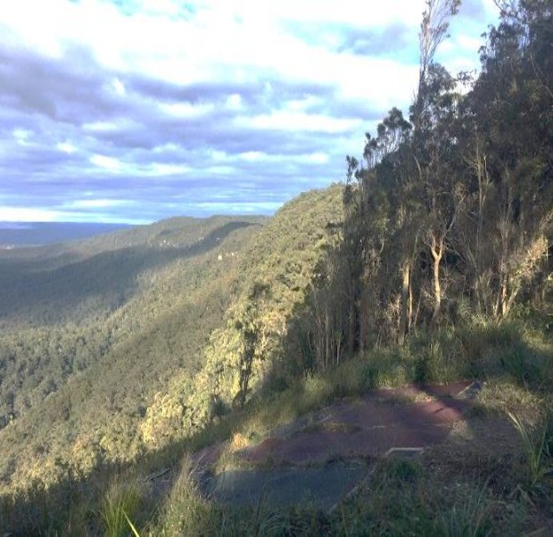
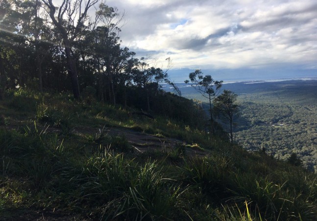
Looking back after launching
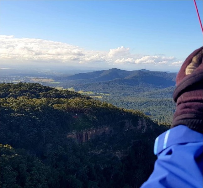
Looking right as you are launching
Looking left from launch
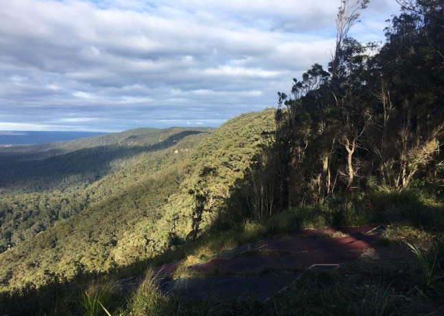
Takeoff
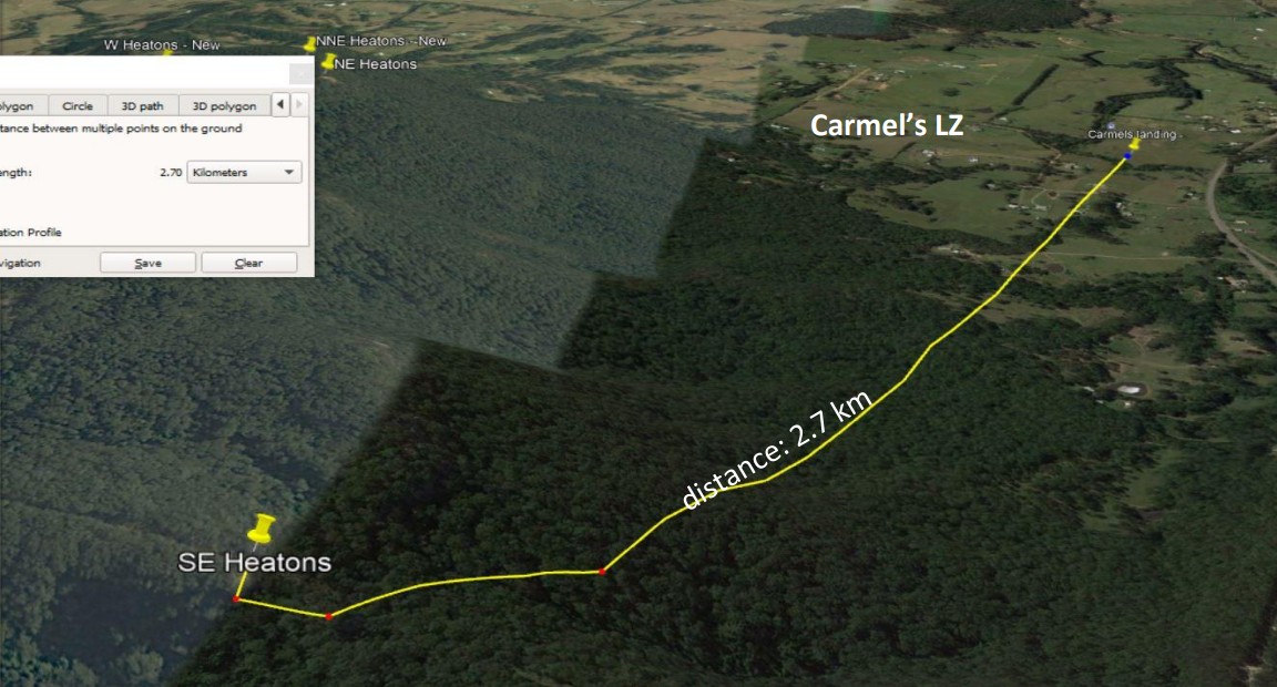
- 407m-53m = 354m height difference.
- 2700/354 = 7.6 to 1 Glide Ratio.
- Great ground handling skills are a must as this launch is very steep to a large drop off into some very large trees.
Landing
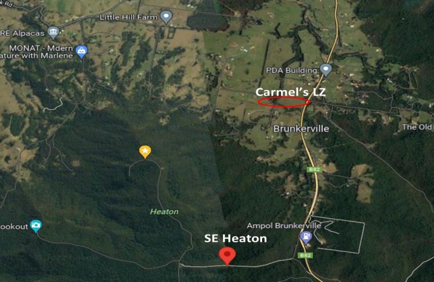
- Carmel’s LZ is open to us – See above image of where it is.
- Other farms do not approve of us landing on their land
- Distance from launch: 2.7km
- Elevation: 173 feet or 53m.
Flight
Airspace
- Class Q – Williamtown airport over launch is Surface to 8500ft.
- If venturing to the west, you will enter Class RMZ – Radio Mandatory Zone –
- Carmel’s LZ has a 4,500′ airspace height limit.
- Cessnock airport has surface to unlimited.
- Check Aviation maps and heights of flight paths.
- Review all airspace here - Aircheck | Australian Airspace & Flight Display - (xcaustralia.org)
Hazards / Comments
- EN B paraglider and above because of the long glide to landing zone.
- Worst case is light winds 2 knots and below, insufficient to stay up ridge soaring but enough to make flying to the bomb out difficult.
- If it’s too strong (~6knots) you will be in a head wind and face extreme turbulence due to sheer cliff in front of launch.
- If it’s too light, you must head straight for landing area.
- This site has large trees and a medium/advanced glide to landing making a tree landing very possible in bad conditions, ropes, spot-GPS and even some dental floss to enable rope to be raised or lowered if caught in a tree.
Emergency Contacts
Incidents might include fire, livestock, vehicle stuck or accident, launching accident, flying near miss with aircraft, a reserve or flying incident or injury landing or other.
- 000
- Newcastle Paragliding club senior safety officer … Contact Us (newcastleparaglidingclub.org.au)
- Williamtown tower telephone - 4034 7973
- Tony Barton – 0412 607 815
- what 3 words app can be used.
Map information
